El Niño is coming! Super El Niño is coming! Monster El Niño is coming! The sky is falling! The sky is falling! Actually El Niño is already here! Just ask Hawaii.
The governor has already declared a state of emergency. Let’s see, how much rain has fallen so far. Oh yeah, zero. How stupid do you have to be? Lest I remind you of 2016 when we had the last super El Niño. The hype for rain that summer was just as bad as it is this year. Perhaps even more so because we were in a horrendous drought. But how much rain did we get that winter? Ah yeah, not very much at all. And we are already in a state of emergency with not a drop of rain yet? My point is, we should not be so sure about what will happen in the future. Don’t believe the hype. Nonetheless, I do have some hope that this El Niño is more like 1983 or 1998 and not like 2016. I think we will probably get above average rain but not the monster deluge that everyone is saying we will get. Also, I think it will be a slow start and it won’t start raining until mid November. Tell me I’m wrong (I hope I am).
I was planning to go backpacking this weekend with Journey. However, I did not think it through very clearly. We had to go to the Bay Area on Friday night to see my daughter’s senior dance solo. We would not get back home until midnight, and now I have to get up very early for a long drive out to the place where we were going to hike? That is not going to happen. I was so tired I could not even drive home from the Bay Area. My wife had to drive. I canceled the backpacking trip and decided to just go on a day hike with Journey.
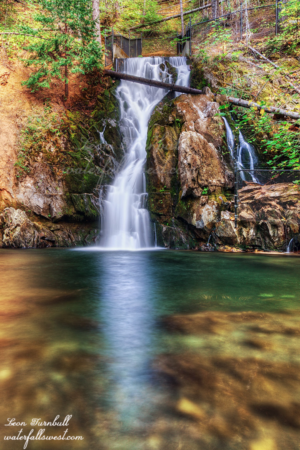
I thought we would return to Sly Park Falls. Something very easy and close to home. I heard there may be fall color there but there wasn’t much. In fact it seemed almost past peak color, which makes no sense seeing as it is not even October yet.
Journey and I have been to this one before. Last time, it was her first or second hike off leash. She did great that time but now she is an expert. She is such an awesome dog.
Somehow I took a wrong turn on the way there even though I was pretty sure we went that way the last time. We ended up having to go off trail to get back to the main track. Journey is good off trail as well even though she does not like it so much. We made it to the waterfall and crossed the creek to get up close to it. The water was a bit cold and I’m sure Journey did not like that part. There is also a new log spanning the top of the waterfall which was not there last time. Interesting. I am glad it is not an unsightly log. We spent some time at the waterfall and then made the hike back up the hill to the car. It was a lovely morning in Eldorado National Forest.
It was supposed to be a cloudy day with rain later so I got everyone up early for a hike to Moyie Falls. Tara, myself, Journey, and my sister and her two dogs.
Well, actually it was kinda sunny. Not very good for photography. Sigh.
It’s an easy hike down to the river, then you cross it and it’s a short walk up to the waterfall. The river was low enough to rock hop across. Even Journey followed Tara across on the rocks but my sister slipped and ended up getting her feet very wet. It helps to have hiking poles. Last time I was here was in winter. I had to cross it on a snow bridge which was a bit freaky. It’s so much easier in late summer.
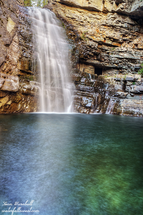
We got to the waterfall and there were some clouds blocking the morning sun so I hurried up to the base of the falls to take pics. The rest of the crew hung back at the first viewpoint. Moyie Falls is a marvelous 46 ft. drop on the Moyie River. Afterwards I crossed over to explore the cave at the waterfall. It is an old mining cave and there are even old train tracks going into it. Going to nowhere. The cave did go in a long way but there was a stream and I didn’t go in too far because I did not want to get my feet wet. We retreated back to the car and house for morning coffee. It was another lovely morning on Day 5 of the Canada road trip in the East Kootenay of British Columbia.
I’ve been wanting to do this hike for awhile. I tried in winter once before but failed. It is just 0.7 miles (1.1km for my sister) but gains 1300 ft. in elevation (396m for my sister). It is no joke. It is also not Journey friendly. So I got up early and drove out to the trailhead by myself.
There’s no parking along the road so I had to drive an extra half mile to a turnout. Not a big deal.
The trail climbs steadily for the entire hike. However, it wasn’t so steep that I was on all fours. It reminded me of the hike up to Ribbon Falls but that one was much harder.
The lower part is fairly easy and the trail is well marked with cairns. Then you come to a talus field to cross. This is the part that would be too difficult for Journey. I think she could have done it if we were careful but she definitely wouldn’t have liked it. After the talus the cairns disappeared. I was not sure which way to go so obviously I went the wrong way. Other people had certainly gone this way but I ended up on the wrong side of the creek. I crossed it and climbed up the steep bank on the other side. All of a sudden, the ground started to give way under my feet and I started sliding down and off the cliff. I caught myself just in time. It was only 20 feet so it would not have killed me but it probably would have hurt. I did end up getting a big cut on my hand as I scrambled to catch myself sliding.
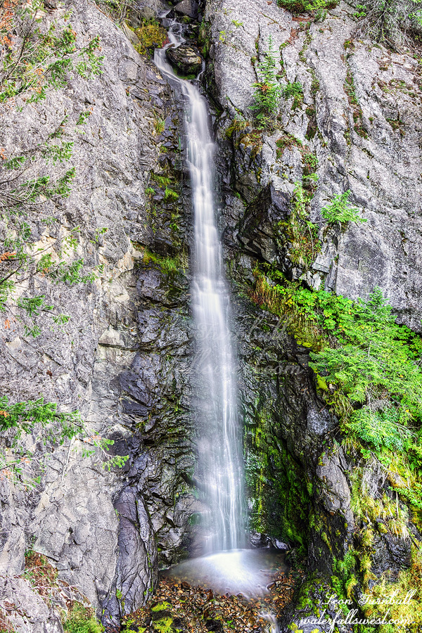
I found the proper trail and continued to the waterfall view point. Maryanne Falls is 45 feet high and it is a beauty. It is bigger than I expected. It looked too difficult to get to the bottom so I did not bother but I enjoyed the view point and flew the drone a bit. Then I scurried down the mountain and back to the house to get coffee. My wife and Journey were still sleeping. It was a perfect morning on Day 4 of the Canada road trip in the East Kootenay of British Columbia.
This is Castelnau Falls, 770 ft. high. It can be seen right beside Petain Falls.
A thunderstorm rolled through in the night. It rained pretty heavily for quite awhile. We were dry but I’m not feeling too keen about the new tent: the Big Agnes Tiger Wall. I had to buy a new tent for this trip because the Durston is not big enough for two people plus a dog. This new one was put through a trial by fire (or water). The problem I have with it is that when you enter or exit the tent the wet fly flaps into the inside and water gets in. We also had this problem on the first night when it did not rain because the fly was wet with condensation. You have to be very careful which is basically impossible. The Durston is miles better in this regard.
In the morning I checked the forecast. It was going to start raining at 10am and essentially rain all day.
It was now impossible to go up to the basin and upper falls. This was a huge part of my planned itinerary but I certainly could not be up in the basin in a thunderstorm and heavy rain. I was very bummed about it but the weather just didn’t allow me to complete my goals. The weather always wins. That’s the problem when you have to make plans months ahead of time. The weather can make or break the trip. At least I made it to the lower falls.
Tara did not even make it to the lower falls. I gave her the choice. We could do a day hike to the waterfall and stay another night. Or hike out today. She decided to retreat and hike out. It was unfortunate but I think it was the best decision. In addition to the rain her sleeping pad had a leak. It was perfectly good the night before but all of a sudden it now has at least three holes in it. What the heck? She would have had a cold night.
It was gorgeous in the morning when we woke up and we had a wonderful breakfast beside the creek. Then we packed up the wet tent and then started the hike back. It started raining at 10am as scheduled. It was light at first but eventually became quite strong. I was perfectly fine with my rain jacket and waterproof gloves but Tara was hiking in a t shirt. She did not have a proper rain jacket with her. Another good reason to not stay another night.
We got back to the car at noon and started the long slow drive back on the horrible road. I swear the drive took a lot longer this time. Along the way we came across a herd of horses and mules blocking our passage on the road. Not wild but free ranging. It was rather interesting to see them. We drove back to my sister’s place in Cranbrook where we would spend the next few days. It was a cold and rainy but still very beautiful Day 3 on the Canada road trip in Elk Lakes Provincial Park.
The road from Elkford to the Elk Lakes Provincial Park is 40 miles of dirt road. 40 miles of hell. The potholes were horrendous. It took 1.5 hours to drive the 40 miles. Tara said she enjoyed it. What? Ok dear, next time you are driving. Along the way we saw a moose and also picked up a hitchhiker, a through hiker who was doing section B of the Great Divide Trail. I knew the GDT ran through here but did not know it went along this road. He was grateful he did not have to walk the very boring road.
We finally made it to the trailhead and started the hike. It was an hour later than I wanted. I gave the GDT hiker one of my Cokes and we parted ways.
There are plenty of park signs along the trail pointing the way to Petain Falls or Petain Basin or similar. Some of them are scratched out. Some are not scratched out. Why are they scratched out, you ask? Well let me tell you! There are five namesakes in this area: Petain Mountain, Petain Glacier, Petain Creek, Petain Basin, Petain Falls. They are (were) named after General Phillipe Petain, a commander of the French Army in WWI. In WWII, he collaborated with the Nazis and was convicted of treason in 1945. The landmarks were named in 1918 or 1919 by the British Columbia government. The name was rescinded around the year 2021.
There are two really stupid things about this: Firstly, why did it take 75 years for the BC government to figure out that Petain was a Nazi ally and revoke the name? Really? They did not know before 2021 that Petain was a Nazi? It is all because of the idiotic wokeness in the world today that they finally decided to rescind the name, I am certain. Ok so great, they rescinded the name. Here is the second stupid thing: give these major landmarks a new name! Don’t just say they are “unnamed” (which is what they did). This is a major mountain, major glacier, and a major creek and they are all now officially “unnamed”. Well … the (reliable) map I am currently using still says Petain Creek (though it does say the mountain and glacier is unnamed). If the creek is still Petain then the waterfall is still Petain Falls. I am going to continue calling the waterfall Petain Falls until the BC government wakes up and gives it a proper name (it might be a long time).
Enough of that dumbness, let’s get to the hike now, shall we? This is Grizzly country. I read multiple reports that people had seen grizzly bears on this hike. I have never backpacked in Grizzly country before. I remember I did one day hike in Alaska where there was a mother grizzly in the area with a cub and the mom had been reported to charge some hikers. I did not have bear spray then but I did the hike quickly and did not see anything. We all had bear spray for this hike. I felt that it was safe enough for Journey to be off leash for the most part. She hiked right beside Tara or myself or in between us for 100% of the hike. She never strayed off the trail. There was just one section where I put her on leash because it was quite a brushy area. Other than that, she was perfectly fine. It has been annoying me recently when I hear non dog owners tell dog owners what to do. Your dog must be on leash! Don’t be a schmuck. I am a responsible dog owner and I know my dog is perfect off leash and deserves to be off leash. The other thing that is apparently abundant on this trail is porcupines. I read that some people saw as many as six porcupines on this trail! I certainly did not want Journey to get up too close to one of those. Yikes. Did we see any porcupines or bears? Keep reading.
Tara’s pack was only 20 pounds or so but she was struggling with it. Lynal offered to carry it for her. It was incredibly nice of him but in a way I wish he hadn’t. They hiked on ahead of us to the waterfall. Tara did not make it. We found a lovely spot by the creek and decided to camp there. But Lynal had her pack. I ran up the trail to find them, almost all the way to the waterfall. They were just on the way back down. We walked back to camp and I set up the tent and we made dinner. We filtered water from the creek. The water from the Elkford campground the night before was horrible but this 4000 year old glacier water tasted amazingly good. After dinner, I hiked back up to the waterfall by myself. I could have (should have) taken Journey but decided to leave her with Tara at camp.
Petain Falls is 305 ft. high and it is absolutely massive. There is a great overlook for the waterfall. You can also go right up to the base of it as well (which I did of course). The mist was tremendous, making it difficult to photograph from up close. Other waterfalls were pouring off the cliff as well from different glaciers. Crossing the creek was not possible. It was absolutely roaring. All of this from glacier melt. I wanted to cross because it’s the only way to see the upper tiers of the falls (it’s over 1200 ft. high in total). I was bummed about that but I expected it. I did walk back along the ridge as far as I could and was at least able to glimpse the upper tiers.
On the hike back to camp I saw a porcupine. This was very cool. I don’t think I’ve ever seen one before. No grizzy bears though. It was a remarkable (and prickly) Day 2 on the Canada road trip in Elk Lakes Provincial Park.