|
|
Easy |

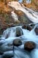
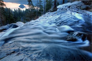
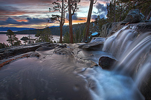
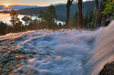
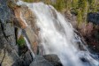
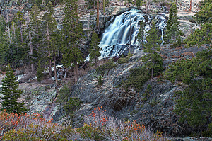
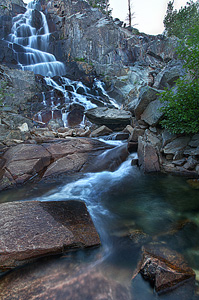
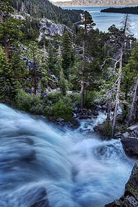
Image 1 of 9; Click arrow to scroll or click image to enlarge Lower section of Eagle Falls (82 ft.) |
Location: South Lake Tahoe, Lake Tahoe Basin, El Dorado County Stream: Eagle Creek Alternate Names: Height: 140 ft. Access:    Distance: 2.2 miles (RT) (hike) Elevation: 6600 ft. (-350 ft.) Season: Apr-Jul Form:  Lat/Long:38.95185, -120.11029 Directions:Along Hwy #89, 8.5 miles northwest of Hwy #50 junction, at South Lake Tahoe. Park at the Emerald Bay / Vikingsholm State Park ($5 fee). |


7 Miles W South Lake Tahoe CA (Elev. 7867 ft)
TonightMostly cloudy, with a low around 40. Southwest wind around 5 mph.
Saturday
A 40 percent chance of showers after 11am. Snow level 8400 feet. Mostly cloudy, with a high near 46. West wind 5 to 10 mph.
Saturday Night
A chance of rain showers before 8pm, then a chance of rain and snow showers. Snow level 8000 feet. Mostly cloudy, with a low around 36. West wind 5 to 10 mph becoming north after midnight. Chance of precipitation is 40%. Little or no snow accumulation expected.
Sunday
A chance of rain and snow showers before 2pm, then a chance of rain showers. Snow level 8000 feet rising to 8600 feet in the afternoon. Mostly cloudy, with a high near 44. Northeast wind around 10 mph. Chance of precipitation is 40%. Little or no snow accumulation expected.
Sunday Night
Partly cloudy, with a low around 36. Northeast wind 10 to 15 mph, with gusts as high as 25 mph.
Monday
Sunny, with a high near 50. Northeast wind around 15 mph, with gusts as high as 30 mph.
Monday Night
Clear, with a low around 38.
Tuesday
Sunny, with a high near 55.
Tuesday Night
Mostly clear, with a low around 41.
Wednesday
Sunny, with a high near 58.
Wednesday Night
Mostly clear, with a low around 42.
Thursday
Sunny, with a high near 59.
Thursday Night
Partly cloudy, with a low around 44.
| High Sierra | Waterfalls Home Page |